Kano State has the highest number of local government areas classified as highly prone to a cholera outbreak, a new geospatial mapping of cholera hotspots in Nigeria has shown.
The Nigeria Centre for Disease Control (NCDC), in partnership with eHealthAfrica, had used advance geographic information system (GIS) technologies to map out areas that are prone to cholera outbreaks in the country.
This geospatial mapping identifies cholera-prone areas with the aim of alerting the government t0 increase preparedness towards reducing the burden of the disease in the country.
The cholera hotspots chart
According to the NCDC mappings, 16 states have at least one LGA identified as cholera-prone. They are Kano, Bauchi, Kebbi, Zamfara, Kaduna, Taraba, Rivers, Borno, Yobe, Niger, Nassarawa, Kastina, Kwara, Benue, Sokoto, and Plateau.
Kano State has 27 LGAs on the chart, followed by Kebbi with 15 LGAs, and Sokoto with 14 LGAs.
Borno, Zamfara, Kaduna states have 10 LGAs each on the chart. Bauchi state has five LGAs, Nasarawa has three, while there are two in each of Yobe, Kwara, Niger states. Kastina, Taraba, Benue, Rivers, Plateau states had one local government each identified.
What is cholera?
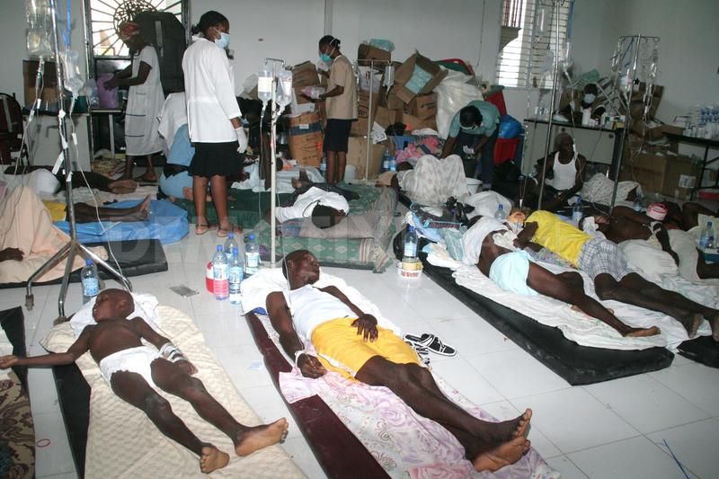
Cholera is an acute watery diarrhoeal infection caused by eating or drinking contaminated food or water. The disease is endemic and has become a yearly occurrence in Nigeria. There is always an increase in the number of outbreaks during the rainy season with over 75 per cent of the outbreaks in the northern part of the country.
Due to the epidemic nature of the disease, the NCDC had included the diseases for immediate notification on the inteIntegratedease Surveillance and response (IDSR) platform.
Cholera affects both children and adults and can kill within hours if untreated.
As at May 30, NCDC said since January, 722 suspected cholera cases had been reported with 28 deaths in the country. The agency said these figures were expected to increase with time.

Cholera hotspots
The NCDC identified 105 local government areas in the country as cholera “hot spots”.
Cholera hotspots are places where the disease is of common occurrences.
According to the World Health Organisation, a cholera-endemic area is an area where confirmed cholera cases were detected during the last three years with evidence of local transmission (meaning the cases are not imported from elsewhere).
Full list of LGAs on the Cholera Hotspot:
1 Kano State – Wudil, Kiru, Gwarzo, Karaye, Shanono, Bagwai, Kabo, Rimin Gado, Tofa, Madobi, Gaya, Dawakin Kudu, Fagge, Ungogo, Bichi, Dawakin Tofa, Tudun Wada, Garun Malam, Bebeji, Rano, Bunkure, Kibiya, Doguwa, Gezawa, Rogo, Kumbotso, Kura
2 Kebbi State – Aleiro, Argungu, Gwandu, Augie, Maiyama, Suru, Koko-Besse, Dandi, Birnin-Kebbi, Jega, Kalgo, Bunza, Ngaski, Yauri, Shanga
3 Sokoto state – Tambuwal, Bodinga, Binji, Yabo, Sokoto South, Wamakko, Dange, Shuni, Sokoto North, Kware, Silame, Kebbe, Shagari, Tureta, Rabah
4 Borno State – Jere, Monguno, Biu, Kwaya, Kusar, Bayo, Hawul, Damboa, Askira/Uba, Dikwa, Mobbar
5 Zamfara State – Gusau, Bakura, Gummi, Bukkuyum, Anka, Maru, Talata, Mafara, Maradun, Birinin, Magaji-Kiyaw, Zurmi
6 Kaduna State – Igabbi, Zaria, Kaduna south, Soba, Ikara, Kudan, Makarfi, Sabon Gari, Kauru, Kubau
7 Bauchi state – Bauchi, Jama’are, Dass, Bogoro, Tafawa -Balewa
8 Nasarawa state – Akwanga, Toto, Obi
9 Yobe State – Gujba and Gulani
10 Kwara state – Ilorin west and Ilorin East
11 Niger state – Agwara and Magama
12 Kastina state -Danja
13 Taraba state – Ibi
14 River State – Andoni
15 Plateau State – Jos North
16 Benue- Markurdi

